Rides We Like: Cafferty Road
(2021) Should someone request a road that encompasses Bucks County - river town, covered bridge, picturesque park, vintage airfield, affluent housing, challenging climbs, state game lands - one road would unhesitatingly be suggested: Cafferty Road. It’s a road that has its own eight-mile Strava segment, but to say it is one road is unfair. It’s a snapshot of Bucks County cycling, and when we rode it yesterday, it was no mistake numerous riders were seen.
When taking it, we always access Cafferty Road from Point Pleasant, PA, to head north. Point Pleasant, PA, is a river town that is one or two businesses away from being something bigger. It’s where Bucks County River Country takes floaters to points up the Delaware River. There was once a local deli. That closed. Now there is a new experience across the street called Kolbe Cafe. There are two closed eateries and one vacant store that has so much potential to make this town into a hip little scene. It’s also where Cafferty Road starts, an easy-to-miss turn off of River Road right before the Point Pleasant Baptist Church. Let us take you the length of this segment to convince you this is the real deal.
The climbing starts immediately. Once past the Ralph Stover Mansion on the right, it is obvious the road goes upward as the Tohickon Creek on the left recedes farther and farther into the hollow. This first portion of climbing is manageable and a sense of serenity comes into play as a peaceful graveyard ushers in the clearing from the hardwood forest. Across the street, in a tiny parking area, a woman was snapping her helmet on and walking to her road bike. The tree cover resumes and the hill goes up again. There is a quaint rock wall along the right-hand side of the road. There’s even a For Sale sign for anyone looking to invest in 56 acres. Only about one mile into the ride and the road is dripping Bucks County.
The road levels out at a small cluster of dwellings. On the right is the real attraction- Tohickon Valley Park and Deer Wood Campground. Here is where trails go into the woods to witness postcard beauty of Pennsylvania’s shale cliffs jutting out from the creek. The Campground was a bit empty; the night before a strong storm dumped a ferocious amount of water. Either the campers fled before the storm or headed home in frustration with wet gear. Normally the top of the climb is met with campfire aroma. Not today. Here is where the climbing is rewarded with a descent past Smithtown Road, one of the County’s numerous gravel roads, and bent away from Twin Lear Road, another gravel road that is more downhill mountain biking than gravel. Between these two spots are a random dilapidated tennis court and overgrown beach volleyball court. Someone thought to put them there; nobody seems to have interest in the upkeep.
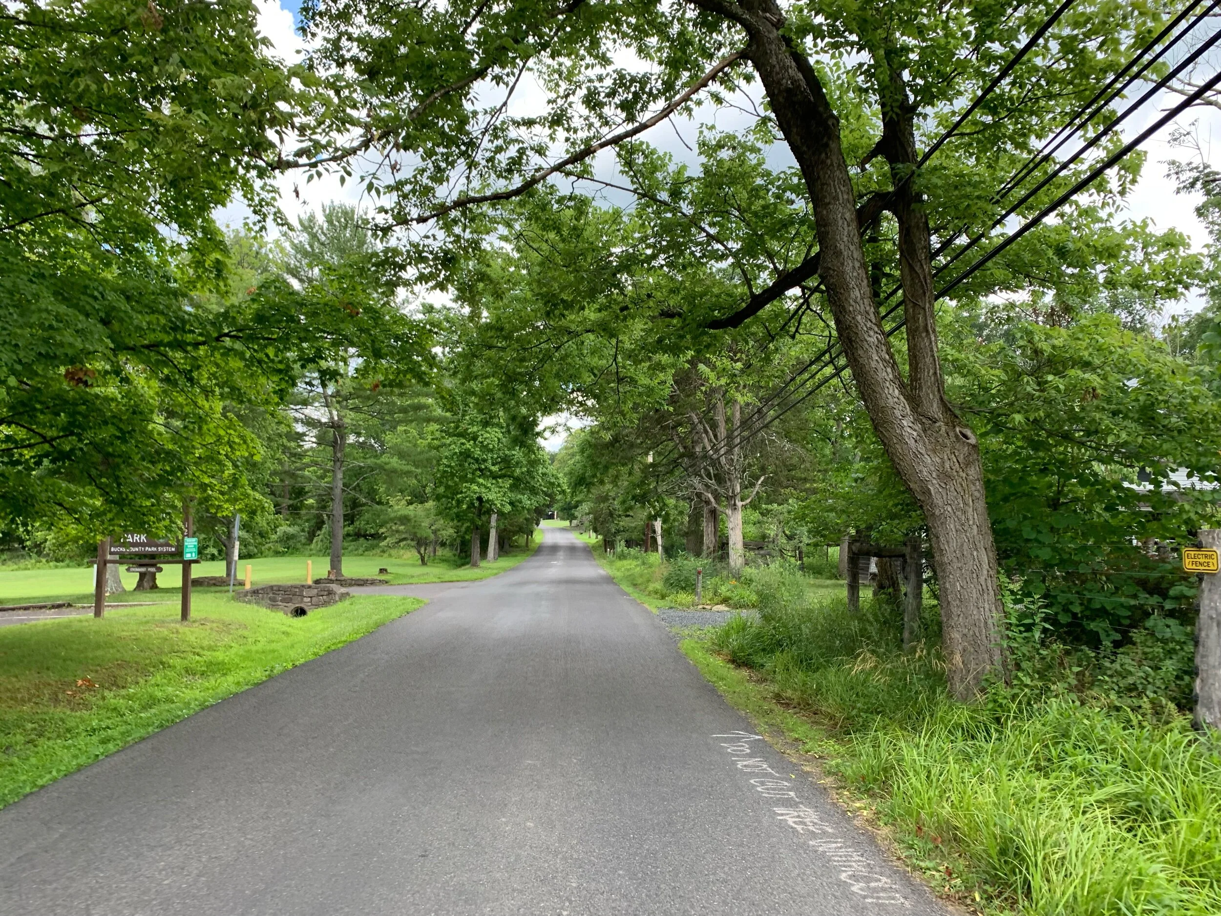
Tohickon Valley Park’s parking lot is on the left followed by the Deer Wood Campground farther up. We don’t remember the rest of the quote spray painted on the road that starts with, “Do not cut tree without…”
The up and down trend continues. After crossing Dark Hollow Road, a wild descent ensues. It is easy to reach notable speeds, but the road features another unique Bucks County experience- a stop sign at an impossibly steep hill. And a lot is going on at this stop sign: traffic from the left has the right-of-way and the covered bridge to the right often has traffic. This is the way people go due to the closure of Headquarters Road bridge. In case there is any concern, there is a split rail fence across from the stop sign for any emergency runaway bike ramps.
This was the busiest section of the day. A car was rumbling through the Frankenfield Covered Bridge and as soon as we started going through, a car came on it behind us. These old structures (though most have succumbed to the Ship of Theseus principal) are a unique Bucks County experience. The structure rattles, the bike shakes, and the accompanying darkness adds to a memorable covered bridge crossing. No sooner were we overtaken by one car, then two motorcycles passed by on both sides of the road. We knew where they were headed but not before having to navigate the punchy little climb that, according to Strava, hits 20% in some spots. Cars went around here, too. This climb used to be so intimidating.

It is a fact Bucks County cyclists can hear this photo of Frankenfield Covered Bridge.
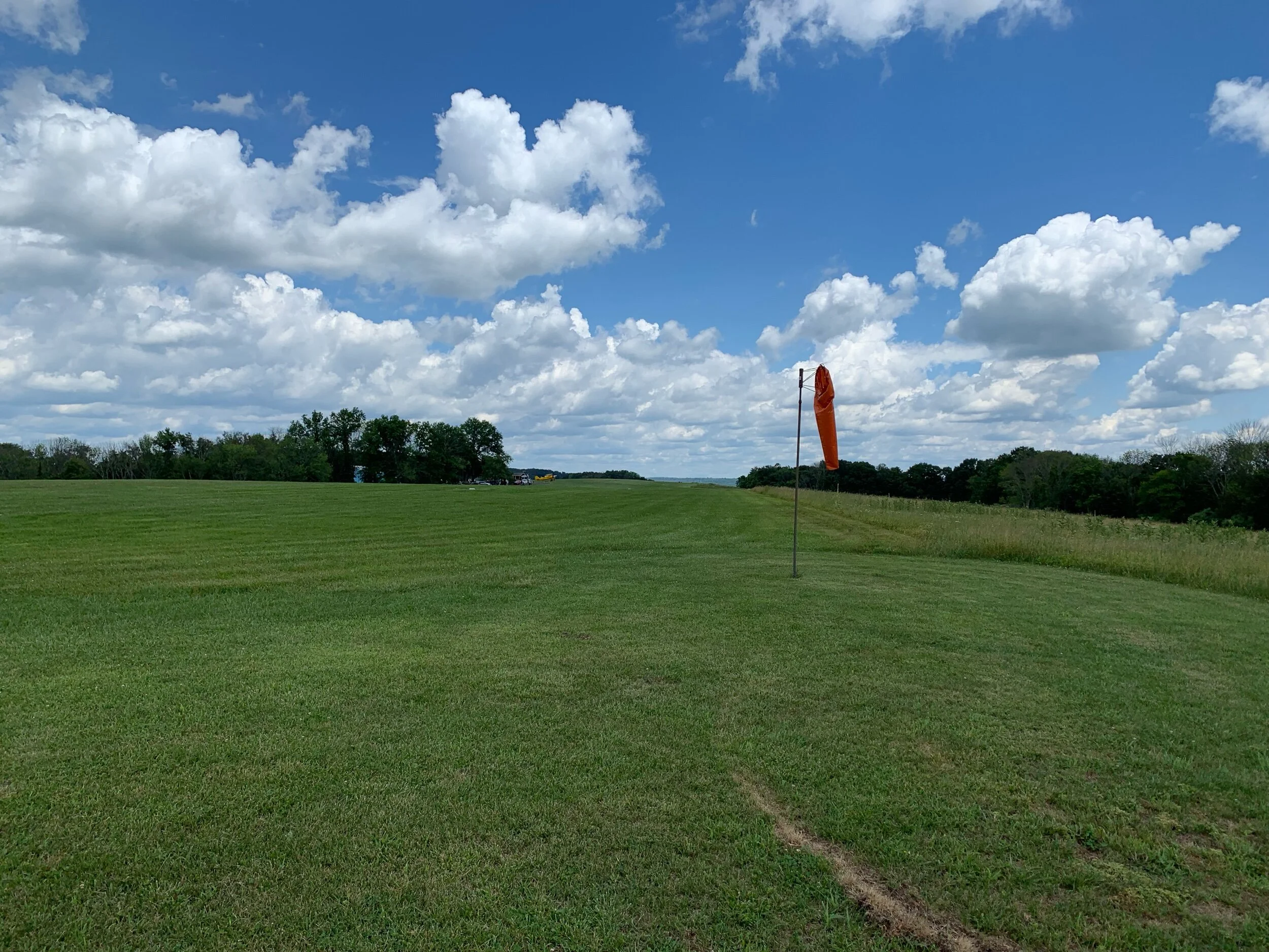
At the top is one of the highlights of Cafferty Road. At first, the sight of a windsock draws curious contemplation. Then there are the signs commanding motorists to continue moving, to not stop, as vintage aircraft will certainly pass overhead (cover photo). Today being the Fourth of July, and having seen the biplanes fly over in formation earlier in the day, there were no aircraft landing at that exact moment. Surely if we stayed for even just a couple of moments, the purr of a propeller engine would have been heard bouncing down the runway. But we moved on to finish out the first third of Cafferty Road.
There are two points on Cafferty where another road must be taken to rejoin it. This is another Bucks County experience. It must be a nightmare for tourists to visit the area who are trying to get places and cannot unpack which road they are properly on. Once past Van Sant, we again light up the brakes to a stop sign at a downhill, join Headquarters Road to rejoin Cafferty. And again the road goes up.
This small middle section is an effort, but it is so worth it. As we power climbed away from Headquarters Road, a mountain bike rider and his knobby tires sung past us, his face adorned with a joyful grin. To the left are a couple of older houses. Up above one of the biplanes was probably lining up the Van Sant runway. We were two minutes too early to leave. Meanwhile a chicane adorns this road. Going down it has always been a concern. Going up it is less of a concern, but not without. The road appears to go around a hole and requires a quick hard effort to get up and over the climb. The road flattens out with deep quiet woods on the left and right before the entrance to one of our favorite roads called Rope Walk Road. Past the entrance the view opens up to fallow farm fields, some full of wildflowers if you hit it right.
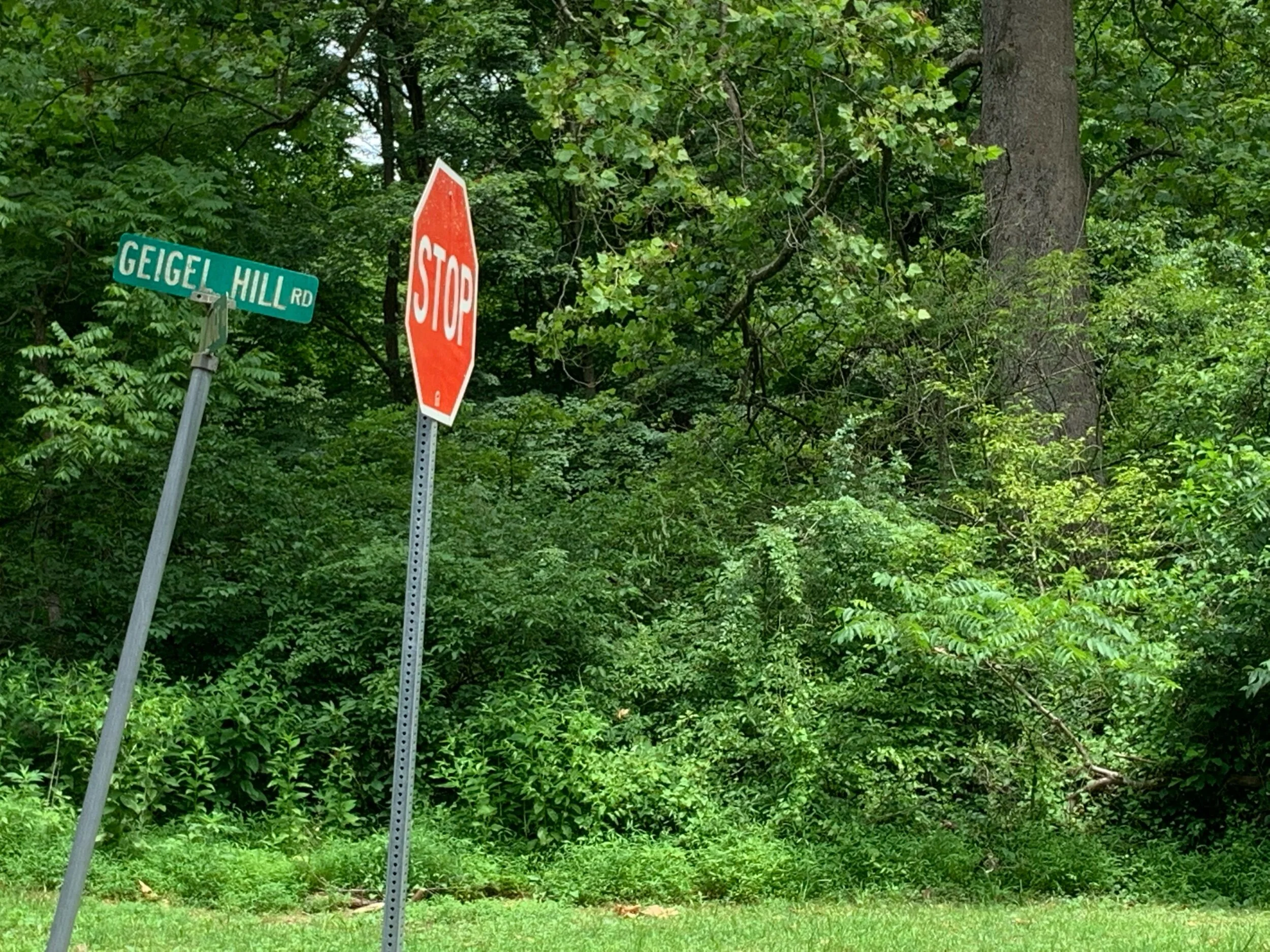
For the most part the hard work is over on Cafferty. The views have been seen. The features have been experienced. Those stinging climbs are past us. But first we have to take Geigel Hill Road to rejoin Cafferty to access the most northern part. Here is where northern Bucks County reveals itself in hardline political signs, hidden houses, historic structures, Go Away signs, and State Game Lands. This slightly unwelcoming area is where the most cyclists were seen, and why not? The roads were shaded perfectly at the time. Here is where trees reach over the road in an attempt to touch the trees across the street. The winding Cafferty northern portion is enjoyable and flowing. It’s peaceful and without cars for the most part. (Just don’t expect any roadside help with a mechanical.) Crossing Rock Ridge Road signifies the Cafferty experience is at its end. Unceremoniously the road turns into Tammany Road. There’s not even a stop sign to tell you. Follow Tammany back around to Rock Ridge, another flowing experience, and Cafferty can be experienced in reverse. We’ve done Cafferty’s full distance from Point Pleasant to Tammany in just over thirty minutes. Not a bad trade-off to experience Bucks County in that amount of time.
If you have ever ridden in a Kermesse event or the Central Bucks Covered Bridges Ride, these roads and sights will look familiar. There’s good reason for that. This area is sought after by cyclists looking for quieter roads with a little challenge thrown in. Where else can someone say they stopped at a Coke machine next to a vintage runway to watch a biplane take off? Better yet, step around the snack stand and test the phone booth for functionality. Riding all or portions of Cafferty is a must-do for any nearby rider. Make sure you don’t ride faster than we did. We like our Strava position on the scoreboard.
Prior to publication it was reported that several riders were assaulted by a blue Mercedes-Benz on the same day only hours after we had ridden through Point Pleasant, PA. One of the riders in the group was reported to have been pepper-sprayed. In the fairness of suggesting these roads, we felt it important to include this information as River Road is heavily populated and can host people who do not represent the larger good.