Rides We Like: Bucks County Gravel Extravaganza
I rolled the gravel bike out on this balmy Saturday with molasses for legs. The ride started with an uncharacteristic tour into a headwind. The goal was to hit gravel sectors around the office with the intent on returning by mid-day. Maybe it was the headwind that made it slow, or the peanut butter gravel after last night’s rain, but the pace began to mimic an adventure ride. Shortly after plunging into a hollow, what I thought would be a standard ride would fall into the definition of adventure.
This isn’t a story in the sequential order of northern Bucks County gravel sectors. Instead it is a tale of gravel sectors chosen. That is, all too many times, I could have added gravel segments to the route. Whether I added a segment was based on time and feel. If a segment was too conspicuous for negative reasons, it would be dismissed. But here the gravel segments are naturally listed in sequential order.
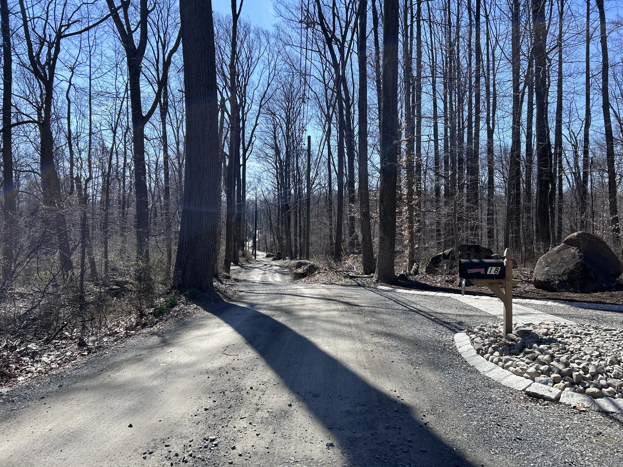
Bucks County really doesn’t have a term for an area between two rollers. Hollow might be the closest label on account of the first gravel segment being near roads called Hollow Horn Road and Dark Hollow Road. Oak Grove Road has many names: Randts Mill Road before becoming Gruver Road until finally settling on Oak Grove Road. It’s a gravel segment that sees a bit of climbing as well as rewarding vistas. While paralleling the main thoroughfare of 611/ Easton Road, it’s easy to overlook its existence. Easton Road can be heard in the distance but not seen. Meanwhile the pasty gravel road introduced me to the day. Last night’s rain meant segments would be sloppy and sopping. Usually a technical descent into a tight climb, Oaks Grove Road was sticky, manageable, and simple. Abnormal, the sentiment of the adventure ride was reinforced by calming the voice encouraging a compensated rapid pace.
Randts Mill Road/ Gruver Road/ Oak Grove Road gravel segment.
The county’s gravel segments are brief. From one to another rolling ridge, Fink Road came into view. Each year this gravel road loses a bit more loose stuff. It was also the widest gravel road of the day as it rolled up to the parking lot for Nox mountain bike trails. Barely ten miles in and two gravel sectors were tackled. The next few would come quickly.
Quarry Road had a road closed sign. Given the presence of a bridge in the hollow, it was nearly skipped on the route. A quick roll over the mound of stones holding the road closure sign in place the bike was sent into the wooded micro valley. With the bridge still intact, it was concluded that the road was closed for the winter. What it also meant was the remaining portion of Quarry Road was all for me after rolling over the second road closed mound.
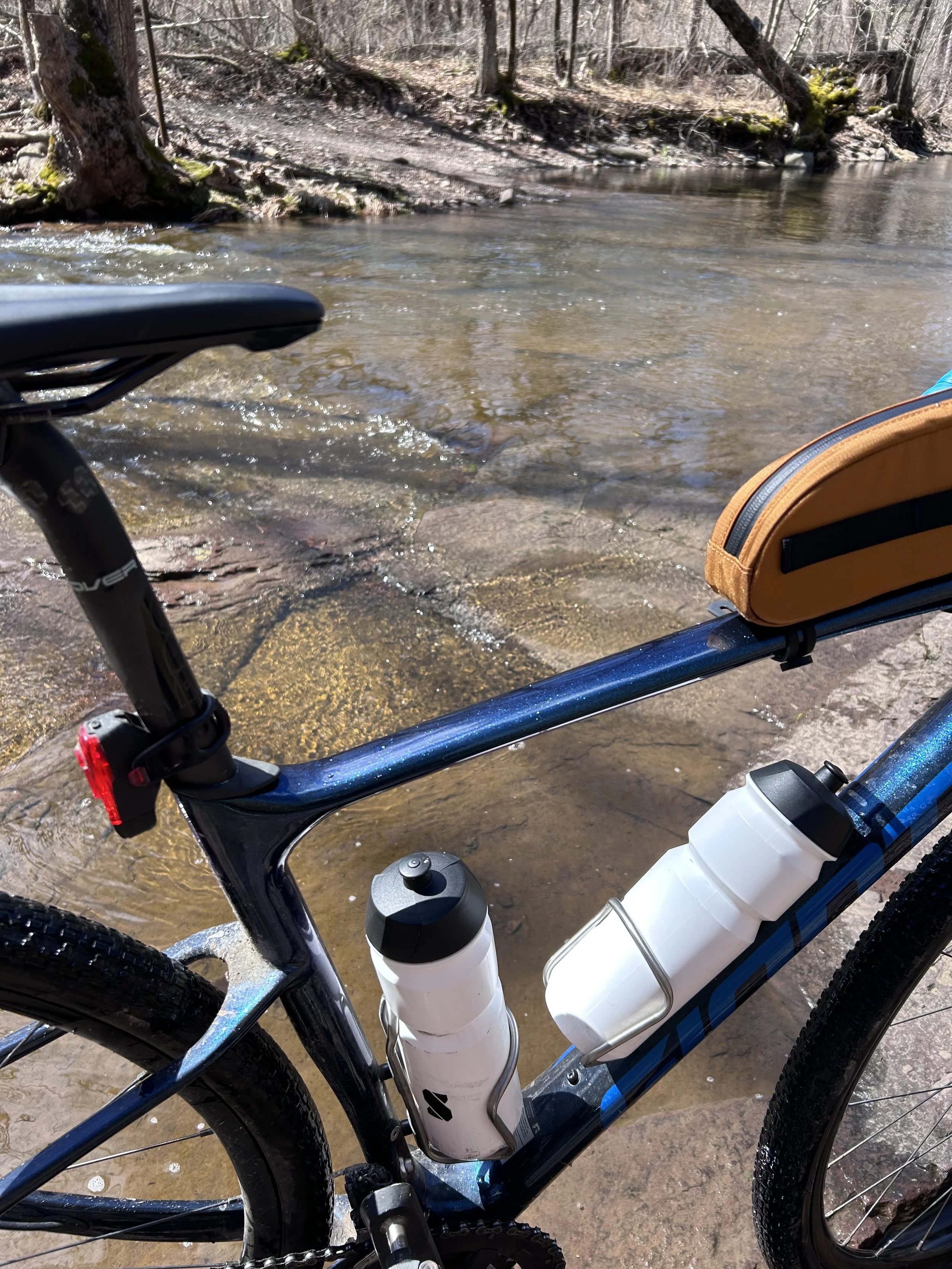
Bunker Hill Road creek crossing number one. Shortly after this ford, another more manageable crossing happens to rejoin regular roads.
I am thankful for gravel experiences like Bunker Hill Road in Bucks County. A recent discovery, Bunker Hill Road features two creek crossings. With small mounds of snow still clinging to the season, it was estimated the Tohickon Creek would be cold and deep. The long and winding downhill was enjoyed with a reservation of brevity. If the creek could not be navigated, I would have to ride back up and reconsider the route. Standing at the creek bank after the enjoyable descent, the waterway was crossable. Whether the shoes would stay dry was the issue. Shuffling down the creek bank, a shallow portion was surveyed. At that time, a motorist in a Ford Ranger pickup truck sized up the crossing. The driver threw it in reverse, leading me to think he had reconsidered. Next the sound of the Ranger revving toward the stream led to a hilarious splashing and plowing. The driver had the biggest smile on his face as two waves lapped the creek shore. Finally the creek was navigated, but shoes were wet and the bike was not ridden.
A short gravel segment between the two crossings was also saturated from the rain and pickup truck. Approaching the second crossing encouraged a high chance of crossing while clipped into the bike. I hammered across Tinicum Creek and bounded down the final gravel length before hitting the next sector.
Sheep Hole Road was once a great gravel experience. Now that the Headquarters Road bridge is out, a structure remaining from 1812, cyclists really struggle to get through. Sheep Hole Road features a shale surface and two trestle bridges, but its construction site blocks further access to Headquarters Road. Without a bridge to access Ottsville and a guaranteed climb in all directions, the next narrative of our ride went missing. I have heard locals and cyclists state that hiking around the construction site can return a determined person back to their path. The other option would be Tankhannen Road, a wooded gravel throughway that linked up with Ridge Valley Road, also a gravel road, before returning to Headquarters. Who knows which one I chose?
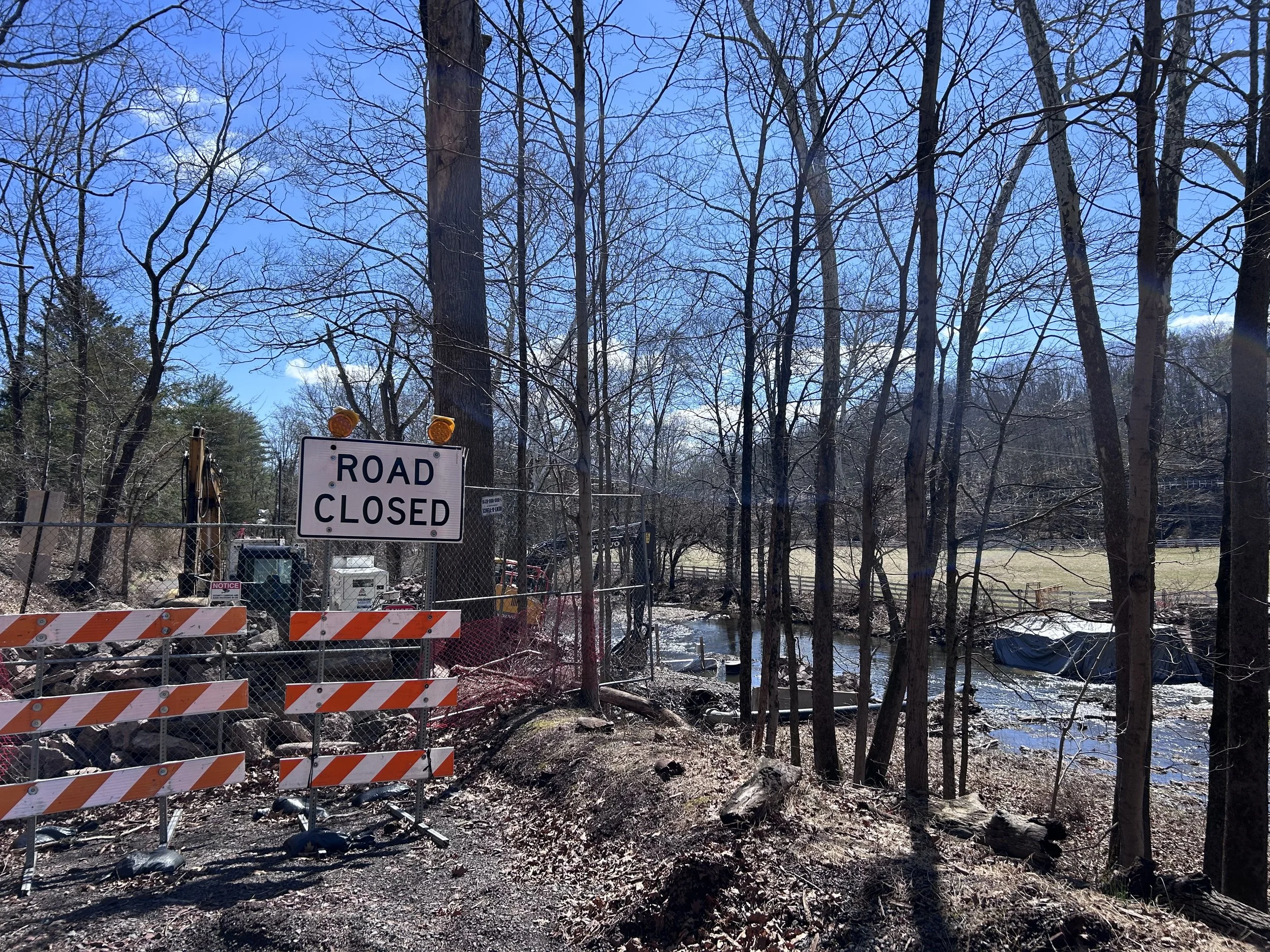
Sheep Hole Road construction meets Headquarters Road missing bridge equalling no through passage unless an interest in hike-a-bike.
Speaking of options, at this point in the ride, gravel roads proliferated. As I topped out along Headquarters Road, the option to plunge down Municipal Road for another creek crossing heckled me. I was so close to considering the crossing, but the steep gravel climb on the other side forced a reconsideration. I could have also taken Tettemer Road, another gravel road pointing northward. Provisionally, I was looking to head home by this point. If I had rolled up and over the ridge by Van Sant Airport, I could have considered Mount Airy Road into Twin Lear, two steep gravel efforts - one up, one down - that would lead me back to my opening miles. I kept thinking of all those unique gravel segments.
“It’s a beautiful space for a picnic, though. But it’s all downhill to that spot.”
Instead I took the gravel towpath south. I paralleled the Delaware River which was in the process of cleaning itself. The chunks of ice had broken free a while ago. Residual autumn debris was finally being flushed away. Two patio chairs were stuck in the southward flow. The Boy Scouts were maintaining their crossing at Treasure Island where I slowed to let a volunteer cut down a fence post. Farther south, a sign alerting motorists of the easy-to-miss Smithtown Road was sniped through the building. This was my exit from the towpath.
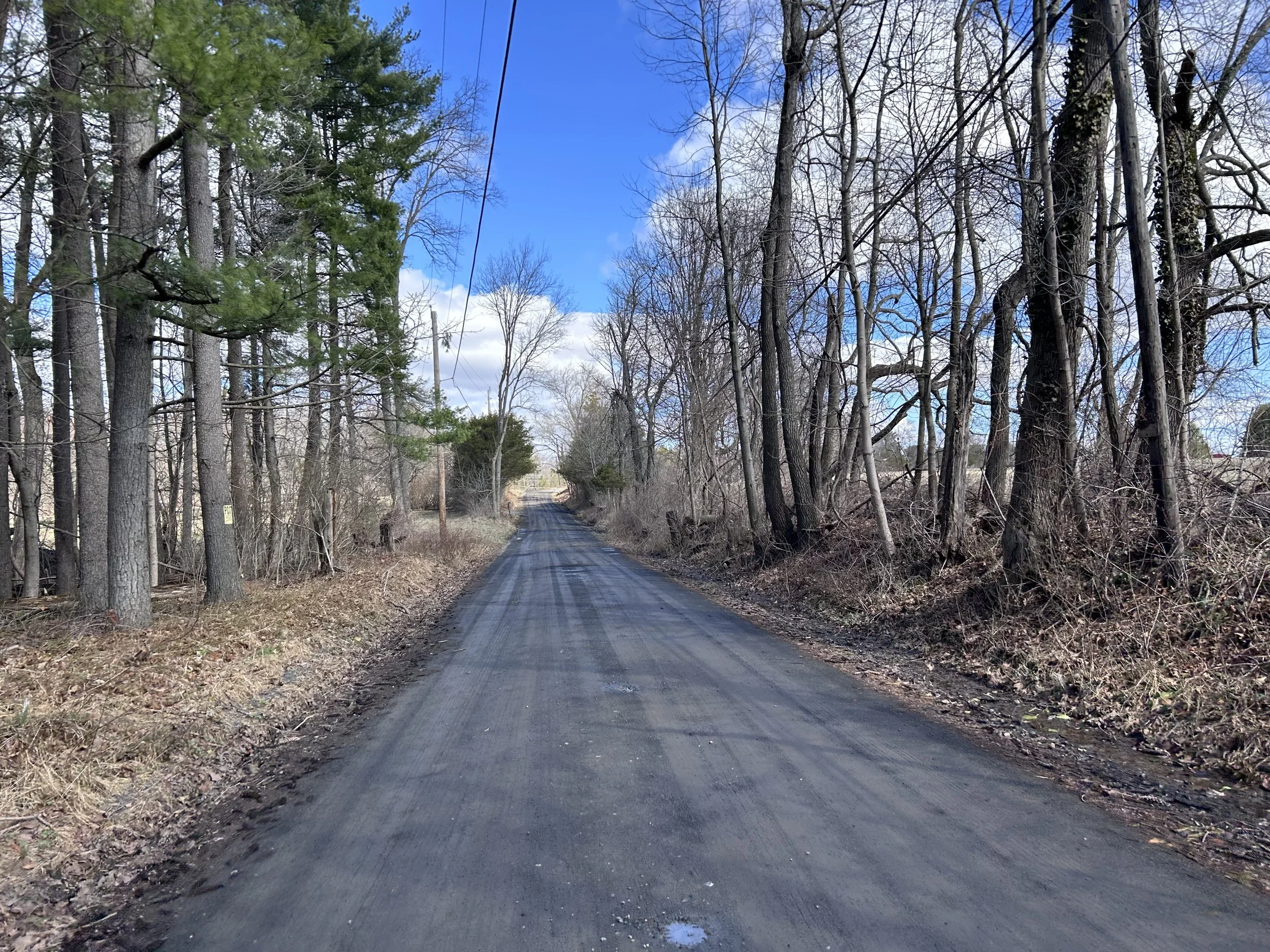
Smithtown is a beautiful gravel road in any season. Just over a kilometer in length, the gentle gravel climb mimics the Smithtown Creek to the left. The occasional waterfall entertains to the right. Still moist from the rainfall the night before, an adventure pace was continued as the road climbed into a soft coniferous forest and occasional abode. It doesn’t get more peaceful than this.
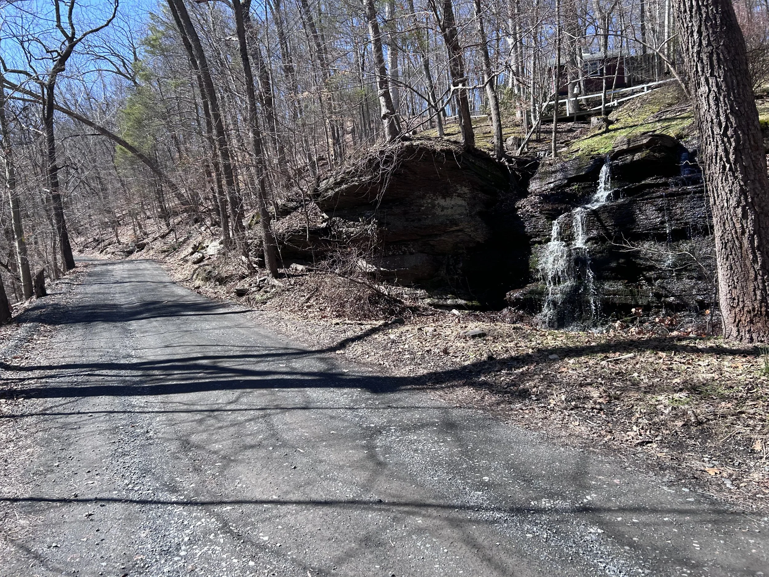
Smithtown Road gravel uphill to Stover Park/ High Rocks with a waterfall and house.
Some of the final gravel segments were coming into consideration. Tory Road, a short stretch that passes the technical mountain bike trails of High Rocks, was negotiated as seasonal potholes made the passage treacherous. Two mountain bikers were egging each other on as I rolled past.
It was at this point I decided to try something. Nearby is an unexplored dead end road called Iron Bridge Road. Per maps, Iron Bridge plunges toward Tohickon Creek. Having crossed one waterway already, why not try one more in the spirit of adventure? No sooner did I turn onto Iron Bridge, than I fortuitously encountered a woman walking her dog.
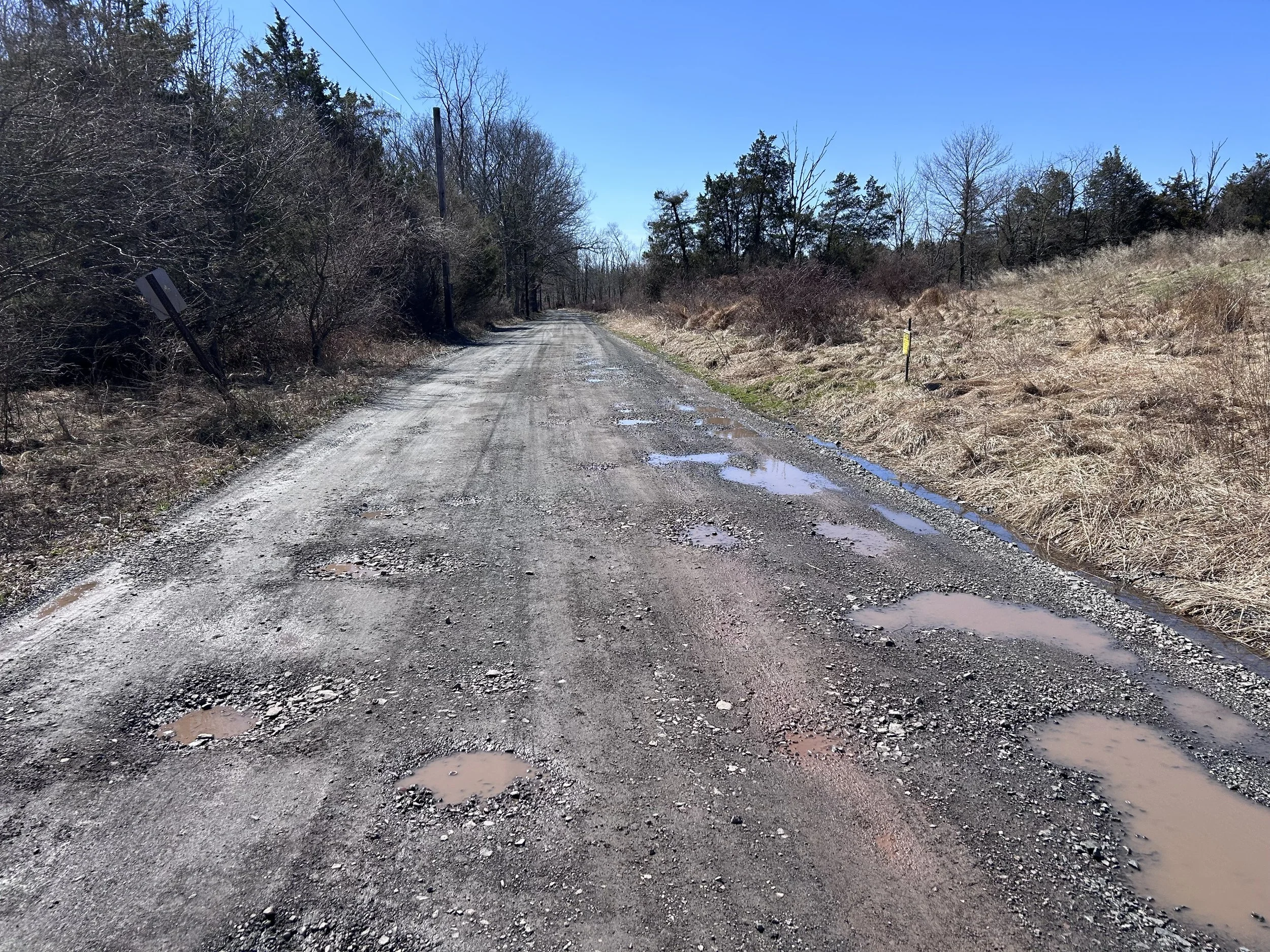
Tory Road, a pock-marked unpaved road that accesses High Rocks parking lot.
“Is [Iron Bridge Road into Tohickon Creek] passable by bike?” I asked.
“Oh no,” the woman convincingly said. “You would be up to your knees if you tried. You might walk across but there are deep places where fish congregate.The bank is a beautiful space for a picnic, though. But the road is all downhill to that spot.” I thanked her for the local insight. She then urged her regal dog to follow, personifying, “Yes, I know you want to hang out with him…”
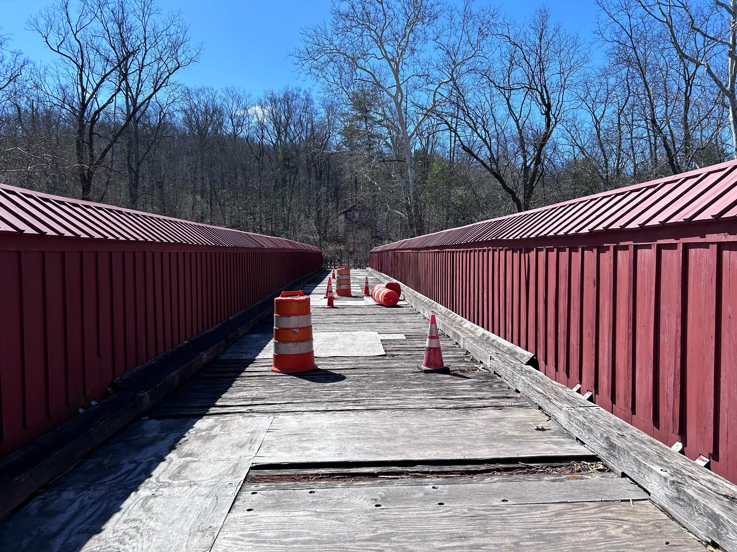
This local gave me all I needed to know. This was not a spot to cross today, but I couldn’t figure out why. Happy to have been convinced to try somewhere else, I considered heading north to return to the opening gravel segment. Instead I dropped into the hollow at Stover Park Road and crossed the decrepit footbridge to put myself within a few uphill miles of home. I was not prepared for an overflowing parking lot where three park rangers were smiling at me as I slowly rolled over the spongy span. It was dam release weekend, and kayakers were loading their cars after a successful run. No wonder the woman said I would be up to my knees if I tried to cross the Tohickon Creek.
The rest of the ride back was paved. There was one more sector I could have incorporated - Bradshaw Road south and downhill to my location. I would have to descend the ridge, ride the sector, and come back up. This was dismissed on account of time.
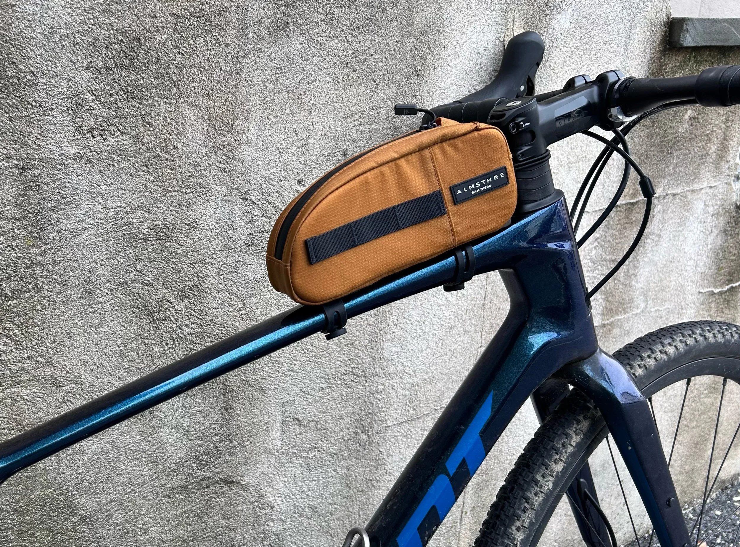
I was properly worn out when I returned home. Having hit eight gravel segments, with the possibility of having explored twice as many, was a relieving adventure. It’s funny when everything comes together for a ride. The Horst spikes gave purchase to hike-a-bike sections along a steep embankment. The ALMSTHRE bag housed Untapped nutrition. The new Pro Discovery bars, recently mounted, were appropriately run in. Combined with the prolific gravel sectors, the outing had everything fall into place. Hopefully I’ll run into some of you on the Bucks County gravel roads, whether they’re in hollows, cloves, or valleys. Maybe I’ll strap the handlebar bag to the bike to experience that picnic spot the lady on Iron Bridge Road suggested.