
Rides We Like: Dogwood Lane Benchmark
(2020) In the forties, fifties, and sixties it was popular for small-scale ski slopes to dot the landscape. They weren’t like today’s resorts. Erase from the mind eight-person chairlifts with climate bubbles or even the upscale gondola. There weren’t hotels and restaurants at the bottoms of these ski runs. Instead there was a chintzy rope tow, T-bar or, if you were lucky, a two-person chairlift to take the load off. Instead of monstrous base lodges, many of these private slopes had a ticket office and the lift line. Hungry? Take note of the restaurants on the way to the hill.
Not far from the creakybottombracket.com office is an example of an old private ski slope. It was a single-run affair called Piper Hill Ski Area. Today the slope, if it has any right to call itself that, is a farm field. What remains is the lodge and the adjoining parking lot. You may have considered dining at the lodge when in Bucks County. Today it is called the Cactus Grill, and it is why the architecture is reminiscent of the ski chalets in Nordic regions. According to ridewithgps, the slope is approximately a quarter of a mile in length with a whopping forty feet of elevation loss, hardly the speed demon destination. But this ski run had us wondering about Dogwood Lane in Durham, Pennsylvania. (Piper Hill Ski Area was big enough to have an on-slope meeting sign, so it must have been somewhat successful.)
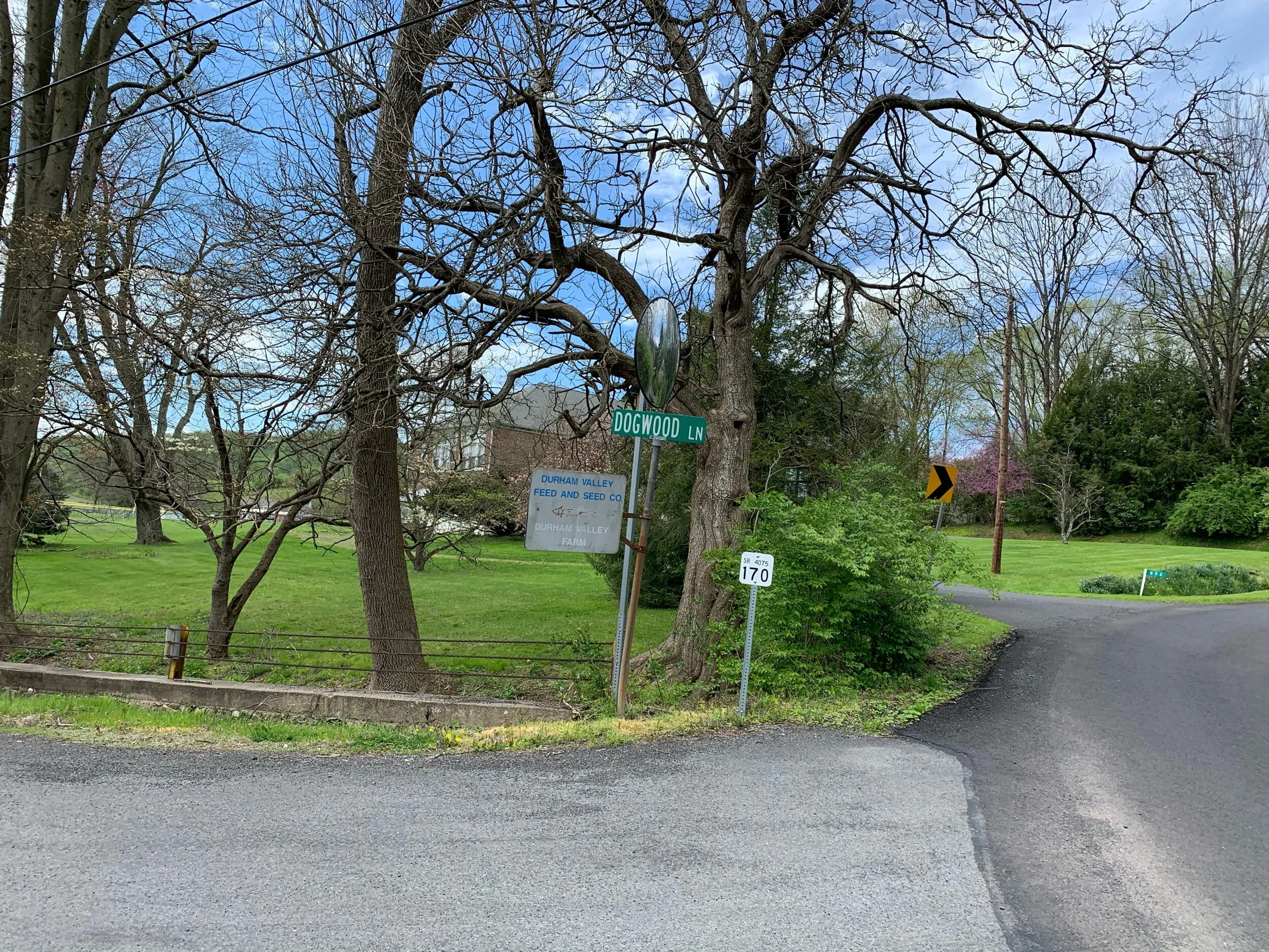
We have written about Dogwood Lane in a previous post but today was a goal-oriented approach. We had the idea to measure ‘preseason’ fitness by laying down a benchmark. Our plan is to return to Dogwood Lane in the fall and see if we fly up in abbreviated time. This concept was initially reserved for Whiteface Mountain in the Adirondacks but two trips to that region - particularly in the spring and fall respectively - is a guessing game of weather conditions. Dogwood’s 1.66-mile uphill route averages six percent and would be a suitable stand in.
Shortly after two short, steep ramps, the road continues upward at a gradual rate.
This climb has been mentioned in Bucks County cycling circles, but what is remarkable is the lack of knowledge regarding Dogwood Lane. Even veteran residents are unawares of this enjoyable effort. It is peaceful, challenging, and picturesque all in one effort. The last portion of it is a product of the next county over. You’ll know exactly when the threshold happens; the single bisecting road is County Line Road. This is a must-visit experience to any rider in the area.
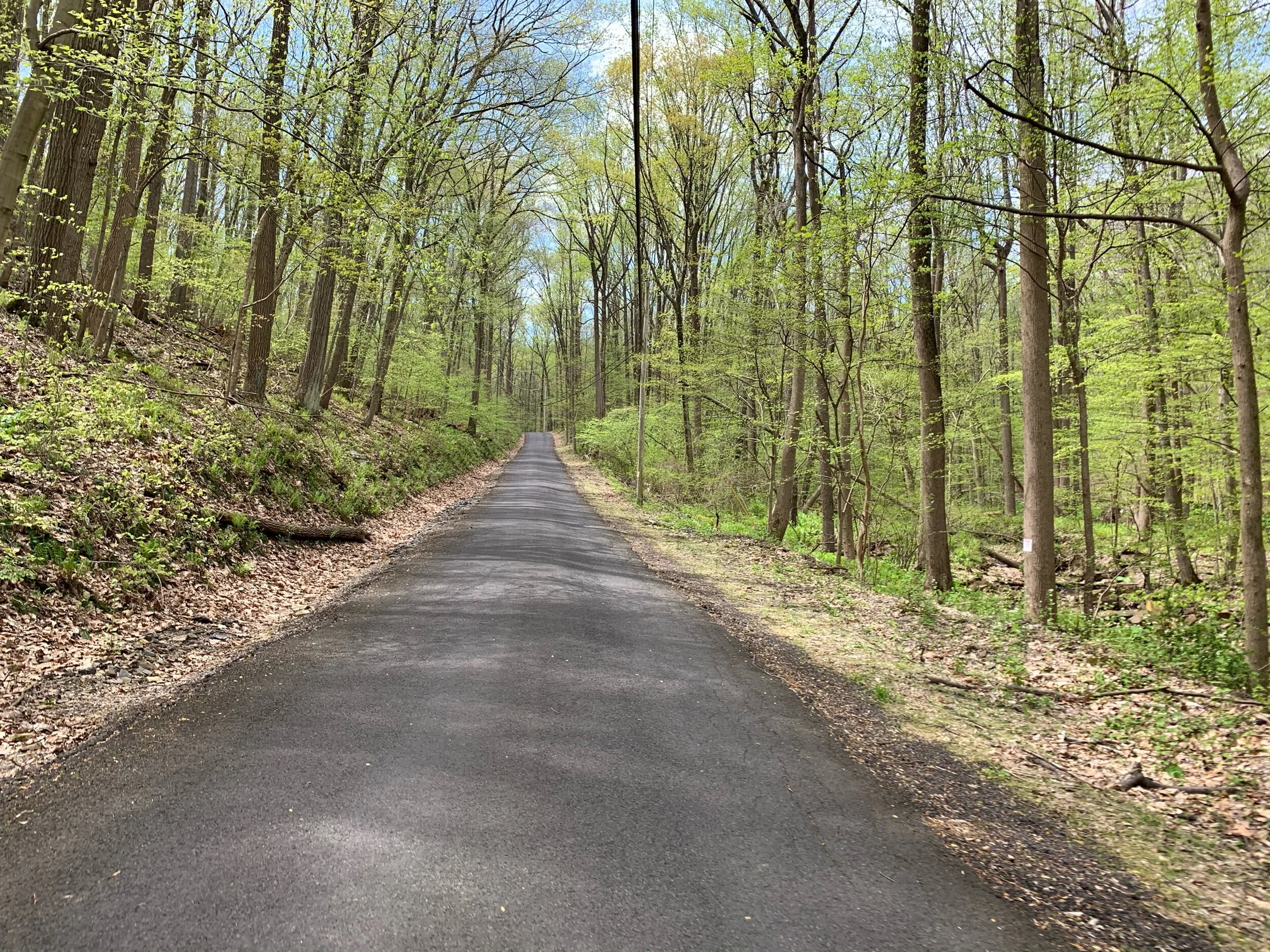
Our thoughts regarding bewilderment as to how this hill avoided the privatization of a ski slope starts straight away. At the bottom of the climb is a bridge where the road crosses a most peaceful brook. Today the route surprised us with nearly 100 meters of unpaved surface. It was long enough to question whether the entire climb was gravel. Perhaps the bridge is being reconstructed. Currently the climbing portion is exactly where the paved road recommences. It does not welcome riders kindly.
The first few sections of gradient are bullish. It is also where the climb plunges into a hardwood forest of old new growth. There are hidden driveways along the climb yet few visible houses. The brook mentioned escorts you uphill for much of the way. The little ribbon of road disappears and reappears as needed to provide inspiration that the climb is not ending anytime soon. The gradient is neither comfortable cruising nor difficult slogging. It is a wonderful test of upward riding. Some of the best segment times are under ten minutes. That’s a long time to think.
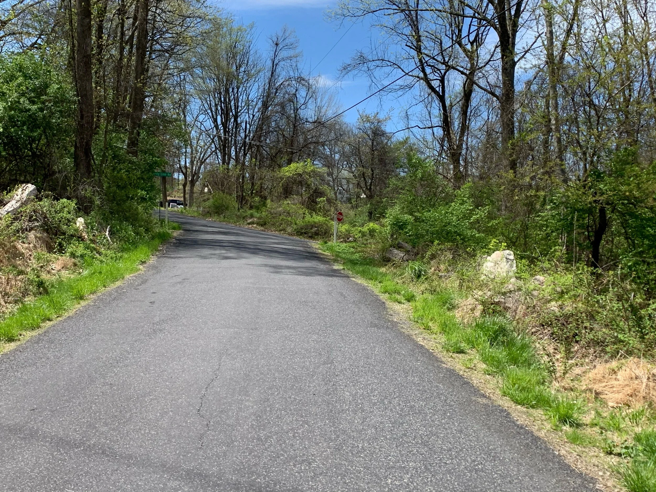
There are only a few places to climb and photograph. This is the approach to County Line intersection and one of the few areas without shade.
Some thoughts pop up in that time span. There are chalet- inspired dwellings on the roadside. At one point the road becomes exceedingly thin, with barely room for one car to pass through. Equally claustrophobic is how close the chalet is to the road. I believe the word for this is ‘quaint.’ It must be awfully peaceful at night in this area. There is a wood stove at the end of a driveway. Random. That one I still can’t figure out. And there is a log cabin with a screened in porch on the right side of the road with a well-manicured lawn. It is marked by an excited Belgian Malinois that leaves us questioning whether it will cross the stone wall and bite into the easy meal of a struggling cyclist. It always sees you before you see it.
But those thoughts return to how great a ski run this road would be. The top of the climb is flat as is the bottom. Rounding out the road to 1.5 miles means the trail would rival the length of Killington’s longest run in Vermont. The hillsides could have been converted into other runs. It bewilders me as to how this real estate escaped the exploratory eyes of post-war entrepreneurs looking for the down-home ski feel. It has the steepness, the length, the water supply, the remoteness, and even room for parking at the bottom.

The summit of Dogwood Lane. The house in the center of the photograph is on the far side of the intersecting road.
The road passes through the odd intersection of County Line Road, meaning we leave Bucks County for a few moments. There is a right-left combination that rounds an impressive personal vegetable garden. Already crops were popping up in rows. The left turn brings the summit into view. As dramatically as the climb started, it abruptly quits. Cherry trees line the right side of the summit straightaway. The view over the shoulder of all of Bucks County is expansive.
The ascent time was satisfactory considering outdoor riding has not been readily available. No matter. This laid down the benchmark for more assaults but especially for the last attempt later in 2020. It will be a wonder as to whether chunks of time fall off or scrapings. Or will time be added due to the lack of events this year and with it training motivation? One thought should be coupled with the ski run concept: Dogwood Lane’s descent is just technical enough that County Line Road was taken for the return trip. Instead of thin roadways and persistent downhills, County Line offered terrifying steep descents into equally steep ascents. There was at least one turn where the bike and rider nearly wound up in the woods. This was all opted over Dogwood’s downhill experience. Imagine if such a trail would be concerning enough for a cyclist to avoid and how much enjoyment it could have brought to a skier for decades.